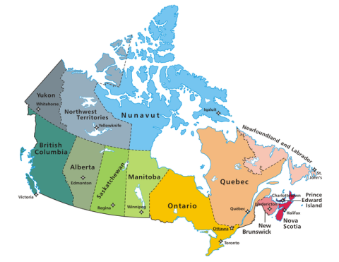
Census Geography
- Reference maps
- 2021 Census
- SGC reference maps (2001 to 2016 Censuses)
- Census Geography Boundary files
- Health Region Boundaries and Correspondence with Census Geography
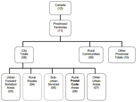
The Geographic Attribute File contains geographic data at the dissemination block level and the relationships to higher levels of geography. The file includes population and dwelling counts, land area, geographic codes, names, unique identifiers and, where applicable, types. Data for higher-level geographies and their relationship with lower-level geographies can be derived by
aggregating DB level data.
SGC concordance tables (xlsx) - These tables describe the changes to geographical classifications between Censuses
- 1996 concordance (1991-1996)
- 2001 concordance (1996 - 2001)
- 2006 concordance (2001 - 2006)
- 2011 concordance (2006 - 2011)
- 2016 concordance (2011 - 2016)
- Interim List of Changes to Municipal Boundaries, Status, and Names (2016 to 2021)
Correspondence Files show the link between old census geographies and new ones. They contain unique identifiers for the current and previous census.
- Census Tract correspondence files
- Dissemination Area and Dissemination Block correspondence files
Correspondence file linking 2021 Census Subdivisions to Self-contained Labour Areas (used, for example, in the Labour Force Survey Small Area Estimates)
Taxfiler Geography
- Taxfiler data are standardised data products generated from T1 tax files by Statistics Canada's Income Statistics Division (ISD)
- A full description of T1FF geographies is available here.
- Taxfiler data is available for Postal geographies and Census geographies
- Postal geographies are based on (or aggregated from) six-digit Postal Codes
- The technical reference guide for the most recent Taxfiler release can be found here.
Custom Geography Metadata
- 2016: Metadata for certain 2016 custom geographies is available here.
- 2021 metadata for 2021 custom geographies is not yet available to be shared. Questions about the custom geographies can be directed to information@communitydata.ca.
Note: you must be logged in to access the custom geography metadata page